Simplifying Ground Movement Monitoring with Automatic Settlement Profiler: A Case Study
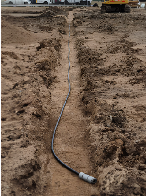
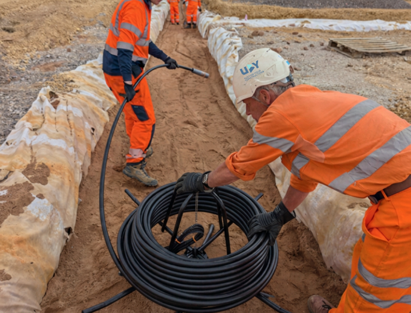
Automatic Settlement Profiler (ASP) being installed in a trench
Introduction
On an infrastructure project, monitoring ground settlement or heave is essential as future assets will be built on it. Furthermore, if a project has varying ground conditions, like that of a project in South Australia in this case study, conventional methods don’t prove to be ideal.
Cost uncertainty, personnel risk with manual intervention, increased overhead expenses in case of duration extension, weather influences; are some of the key factors influencing the choice of a ground monitoring solution. From conventional methods through automated technologies such as Osprey’s Automatic Settlement Profiler (ASP), each approach offered different advantages and limitations.
This article explores the assessment process, the challenges associated with conventional monitoring methods on this project, and the factors that ultimately influenced the final monitoring strategy.
Why is conventional ground monitoring not the best option for this project?
Large-scale infrastructure projects involve many complex activities beyond just building the finished asset, such as a bridge or a tunnel. Existing infrastructure may need to be relocated, while surrounding structures must continue to operate safely. Before moving to the next phase, the project team first needs to be confident that the actual ground behaviour is in accordance with design expectations.
For example, on this South Australian project, existing utility pipes are being moved to a new location, and a road being relocated on top of that. Furthermore, large volumes of soil are excavated or placed, for future embankments and road interchange. Some of these sites have unconsolidated soil that needs to be compacted to ensure it is suitable for future activities.
Normally, the following conventional ground monitoring methods would be used in this situation:
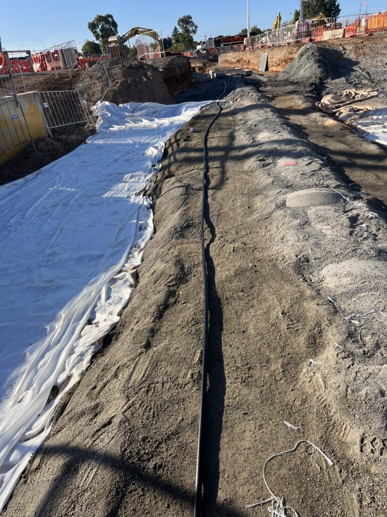
Construction site with geotextile (left) that will cover ASP (center) and the utility pipe (right)
Using Settlement Plates for Surface-level Manual Surveys
To monitor the soil deformation at a specific elevation; engineers use settlement plates. While they enable measurements to be taken at specific levels within the soil stratum, they require ongoing site visits and physical access to each monitoring point. That is both for taking measurements as well as for extension of rods and relocation of prisms if the ground level is changing due to fill placement.
Not only is this time consuming as it requires work to be performed on site, but above all, it can pose substantial safety risks for the people performing the survey on site. These risks arise due to factors such as hazards from site conditions (e.g. steep slopes), nearby construction activities, and the movement of heavy plants. Settlement plates/rods are also more likely to be damaged as they protrude from the ground surface. Therefore, they are exposed to impact from plant machinery on the project site, which is a significant liability during earthworks activities.
Source: Geoants
Deploying Liquid Level Settlement Systems in the Ground
Considering the limitations of surface-level manual surveys, project teams typically rely on another method such as liquid level settlement monitoring systems. The system requires a specialist for installation, and someone for ongoing inspection of the reservoir to check if it needs a refill.
Moreover, this system is affected by several inherent limitations. While the sensors in the system that are buried underground experience relatively stable temperatures, the tubing connected to the reservoir is directly exposed to the ambient temperatures. Consequently, when the system measures pressure changes associated with the ground movements, it can also be influenced by thermal fluctuations.
In addition, air bubbles can get trapped inside the tubing during installation or operations. This can interfere with the liquid flow and adversely affect the quality and reliability of the data. These factors can lead to increased time being spent on data inspection, validation, and analysis to distinguish genuine ground movements from measurement anomalies and potentially delaying important decision-making on site.
Considering these challenges, the UBY team provided a solution for continuous vertical measurements (heave or settlement) without requiring manual intervention after installation. This is where Automatic Settlement Profilers (ASP) provide a practical alternative.
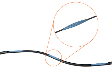
ASP is a distributed settlement monitoring system designed to measure change in the ground elevation by measuring the differential pressure. Sensors are positioned at predetermined intervals to track vertical displacement across a profile of a monitored area in near real-time.
Since ASP has a sealed system with environmentally safe Aqueous Glycerol Solution, it significantly reduces the effects of atmospheric pressure and weather changes. Unlike the conventional methods, this gives more reliable data without needing manual adjustments of barometer readings. This is because the entire ASP system is underground, keeping the temperature conditions uniform.
For this project, the team is using custom-built ASP with sensors at different intervals to measure the ground settlement or heave. The sensor offers a 5m differential range with ±1 mm precision. Installed in a sand-filled trench in which the Automatic Settlement Profiler is buried, it is inherently protected unlike settlement plates that are often subject to disturbances.
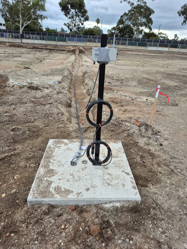
As it’s a low-power instrument, a single datalogger for one cable of ASP sensors is enough to transmit the data automatically to UBY’s uMonitor platform. The cable from the sensor to the datalogger could be supplied at a required length to install the datalogger in a safe area, outside of construction activity, and be easily accessible.
ASP connected to a datalogger
Lessons from the Field
Here’s how UBY installed it
One of the ASP installations is located along the utility pipe and is intended to monitor its behaviour along with the surrounding ground while the road is constructed above it. The data will be used to assess any movement or deformation that could affect the integrity and performance of the relocated assets, months after they are back in use.
The second ASP system is installed in an area where an interchange will be constructed. It shall monitor the settlement of natural ground during the placement of a surcharge load. The ASP will be installed after the initial preparation works, and monitoring will continue throughout the surcharge period to measure the ground response.
The data collected from both the ASP installations will be analysed to verify that movements remain within the established acceptance criteria. Furthermore, this information will help assess the stability of the ground and infrastructure as well as support decisions regarding progression to subsequent construction phases.
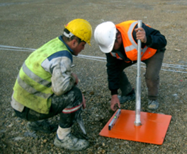
UBY team installing ASP
"ASP is one of the easiest instruments I've ever installed and set up. It fills an important gap in ground monitoring, delivers reliable data, requires virtually no maintenance, and does exactly what project teams need it to do."
Pro-tips to Install ASP
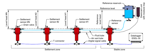
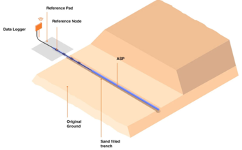
The first sensor in the ASP, closest to the datalogger, should be considered as the ‘reference’.
It should ideally be placed outside the zone of influence on a site. If that’s not possible, monitoring the reference either with a manual survey or GNSS system is key.
It’s important to place the reference in the ground, like the rest of the ASP chain, to mitigate the effects of thermal fluctuations of the environment.
Diagram explaining the installation of ASP
Improving ASP data with the robust uMonitor platform
To enhance the data from the sensor and provide a complete solution to the client, it was combined with the uMonitorplatform. These features from the monitoring software are proving particularly indispensable:
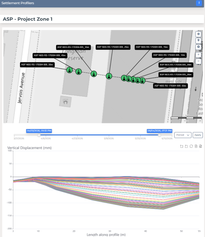
Advanced ground movement visualisation: Engineers can visualise settlement profiles along the ASP alignment and identify localised trends that may not be apparent from individual sensor plots.
No-code settlement calculations: Settlement measurements are automatically converted into elevation changes within uMonitor, eliminating the need to maintain custom processing scripts.
Custom time frame analysis: With the time bar at the top of each individual graph, ground movement trends can be viewed over a custom time period for a specific area.
Single platform for all data: ASP is being used alongside other sensors like GNSS, inclinometers, AMTS and prisms, etc. on the project. Instead of platform-hopping for all of them individually, they are now centralized on one platform, providing a holistic picture of the different sites of the project.
Personalised Automated reporting: Daily/weekly/monthly changes in the ground movement are reported automatically to the stakeholders with the help of personalised templates, saving significant time.
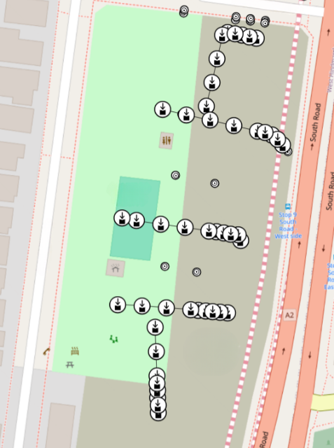
ASP placements on map on uMonitor platform
ASP settlement report of vertical ground displacement on uMonitor
Looking ahead on the use of ASP
An infrastructure project’s success depends on selecting the right instruments, installing them correctly, establishing reliable reference points, and ensuring the resulting data can be used to support project teams to make informed decisions. Whilst maintaining safety and remaining within budget constraints.
On this project in South Australia, the use of ASPs has enabled UBY to deliver a turnkey geotechnical monitoring solution that reduces installation effort, minimises maintenance requirements, and provides clear insights into ground behaviour during critical construction phases. By combining innovative instrumentation with UBY’s practical monitoring expertise and advanced uMonitor platform, the project team has saved time, reduced on site work, and enabled verification of actual ground movement trends against design expectations. Overall, this solution helps better manage the costs and risks associated with monitoring ground movement.